Trekking in Ladakh- Padum to Martselang Trek

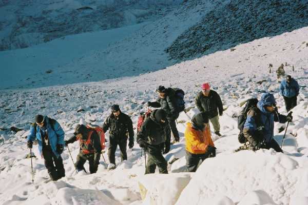
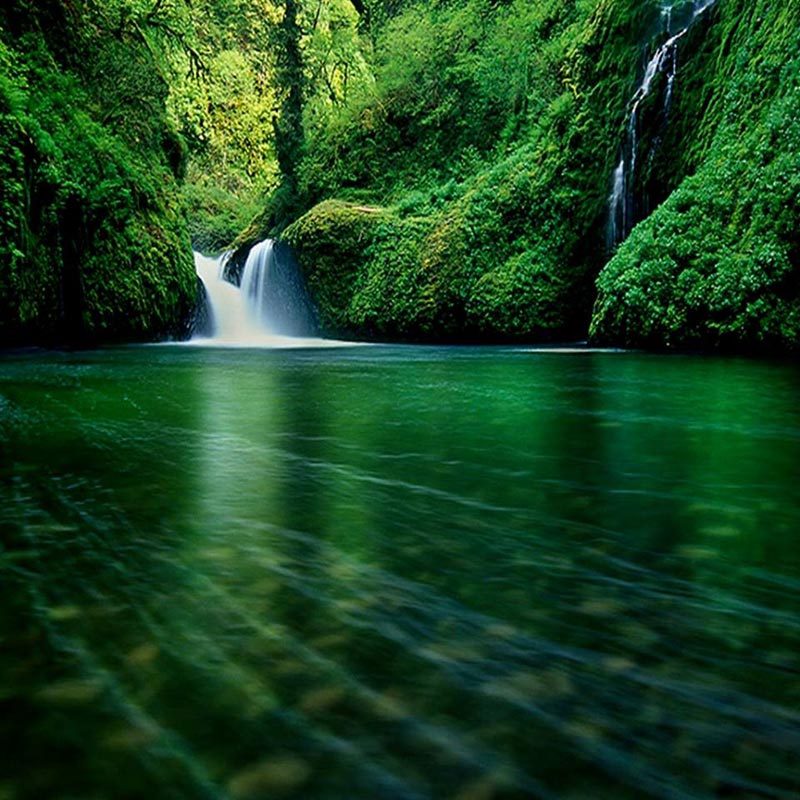
The Landscapes of Ladakh has been compared to the bleak surface of the moon. Images of the barren lunar vistas are similar to those obtained of this trans-Himalayan region. But its ecosystem is remarkably Vital. The trail takes you through a stretch remote even by lofty Ladakhi standards. Because of his isolation, it is an excellent place for viewing wildlife. With not less than sixty river crossing, the trek also provides moments of great adventure.
Main Highlights of this trek: Remote, barren and rugged landscape which is home to some of the best wildlife in Ladakh. Spectacular rock formations and clear blue mountain streams are irresistibly attractive. The steep passes, deep gorges, and several river crossing make it one of the most difficult trek. High adventure is the name of the game!

Duration: Maximum - 09 Days from Zangla; from Padum - 11 Days
All the treks of Leh is connected by 'air' with Delhi, Chandigarh, Jammu and Srinagar to the west and from Manali to the South.
Best time to Visit: June to September.

ITINERARY

Day 01:

  • First day we will start this trek from Padum. Reach Padum by road from Kargil or the trail from Darcha. A short drive on a dirt track takes you to Zangla, the erstwhile capital of Zanskar, thirty-five kilometers away from the headquarters. The trail climbs through the village to the right bank of the Zangla stream and ascends into the valley. Clumps of willow bushes are found. With no permanent trail on either bank, you have to ford the stream at least twenty times. In around five hours you reach the campsite of Zumlung Sumdo (12,400ft / 3,780m).

  • Day 02:

  • For the day of Second the climb begins just after the confluence on the left of the valley. A two-hour ascent takes you to the point where the switch backs begin and a three hour climb takes you to Charchar La (17,094 ft / 5,210 m), marked by a chorten. The descent from the pass takes you on a gradual slope till the trail meets the Zumling stream. In little short of an hour the river enters a deep gorge. The gorge is so narrow that the ponies have to be unloaded. The hill across the side stream is an excellent spot for viewing the ibex. Another animal not way difficult to sight is the blue sheep.
  • Day 03:

  • Third day follow the Zumling downstream after leaving camp. The hills on either side are covered with willow; that makes it difficult to move on the trail, forcing you to cross the river occasionally. As zumling is the fast-flowing river, use a rope to cross the stream. In six hours, reach the confluence of Zumling with the Khurna. Cross it to reach the Campsite of Tilut Sumdo (12,500 ft / 3,810m) on a ledge just above the camp.

  • Day 04 & 05:

  • Forth & Fifth Day follow the Khurna upstream on its right bank. The trail shifts to the left bank within forty-five minutes as the river comes down to hit against the mountain and swerves left. The crossing is difficult. Cross back to the right bank in another forty-Five minutes and after a thirty minute walk, leave the Khurna to enter a side valley. The trail climbs steeply through the gorge and it's a bit of a scramble when it disappears. But the valley starts widening and after two hours, the trail reaches a fork where two streams meet.

  • Day 06:

  • Leave camp early to cross Zalung Karpo La later in the morning. The trail climbs up the valley as it curves right and reaches the confluence of the streams descending from the Rubarung and Zalung Karpo Passes. The trail over the former goes into the Markha Valley. Following the trail, going into the valley on the right, you reach switch backs climbing to a huge slope. Avoiding the trail going down from the pass, take the ridgeon the left for fifteen minutes to reach some prayer flags. Descend steeply on the trail, following a stream on its right bank till it meets another small stream.
  • Day 07 :

  • An hour after leaving the camp you reach a mane wall where the trail bifurcates. Take the one going up, climbing steeply to the west ridge of the Kang Yurze with cairns and flags that mark the Konka Wangpo La at 16,667 ft / 5,080m, and descend to a valley.

  • Day 08 :

  • Long switch backs take you to the top of Kangmau La (16,706 ft / 5,200m), the Pass of Red Clay. There are ochre and maroon-coloured hills around. The Eastern Karakorams are clearer from this point, with the Saser Kangri's summit dominating the range. A sharp descent takes you down to the head of the Martselang Stream - another great area for viewing blue sheep.
  • Day 09:

  • A short walk along the Martselang stream takes you to Indus's banks. Alternatively vehicles can be brought up to Sumdo for the drive to Marselang over a rough road. You have fared well on atough road. You have fared well on a tough trek and maybe seen some rare wildlife too.
  • Important Facts of Darcha Padum Trek

    Duration : 9 Days from Zangla; from Padum, 11 Days
    Degree of Difficulty : 5 -Rigorous on the trek.
    How to Reach : All the treks of Leh is connected by 'air' with Delhi, Chandigarh, Jammu and Srinagar to the west and from Manali to the South.
    Permits For Treks : A climbing Permit, required for all peaks over 19,700 ft / 6,000 m is obtained from the "Indian Mountaineering Foundation based in Delhi.
    Altitude : Padum is at 11,800 ft / 3,596 m and Zang La at 12,000 ft / 3,657m The highest campsite is at the Langtang Chu at 14,200ft / 4,328 m. The three high passes are Charchar La (17,100 ft / 2,164 m)
    Highlights of Treks : Remote, barren and rugged landscape which is home to some of the best wildlife in Ladakh. Spectacular rock formations and clear blue mountain streams are irresistibly attractive. The steep passes, deep gorges, and several river crossing make it one of the most difficult trek. High adventure is the name of the game!
    Support Services : Pack mules and ponies available through the advanced requirements, but not available on arrival in stock or Martselang. Other arrangements, including hiring equipments or trekking kit, can be arrange in Leh. Be self contained for the trip; food and camping provisions must be carried from Leh. Trails are not well maintained and can be washed away. A guide will be a big help to chart out the easiest way to the top of the peak.
    Emergency : Only basic medical facilities are found in Padum. Reasonable medical facilities in Leh, especially in the army hospital, including high altitude rescue facilities. On trek, however, there is no place to call for help. Rescue facilities are possible but very hard to arrange.